Super El Niño Breaks Pacific Ocean Temperature Records as Global Climate Risks Rise
Record-breaking temperatures in the tropical Pacific have raised concerns that the developing super El Niño could become one of the strongest climate events in modern records, disrupting rainfall patterns and increasing the risk of extreme heat, droughts and flooding worldwide.

The developing super El Niño has pushed sea surface temperatures in a key region of the central tropical Pacific to unprecedented levels, raising concerns among climate scientists about its potential effects on global weather. On October 8, 2026, the World Meteorological Organization (WMO) reported that temperatures in the central and eastern equatorial Pacific were expected to reach approximately 3.7°C above normal during October–December. This would exceed the previous record anomaly of 2.6°C recorded during the 2015–2016 El Niño. The latest observations follow a rapid intensification of the phenomenon since mid-2026, with scientists warning that the event could become one of the strongest since systematic monitoring began in 1950.
El Niño is a naturally occurring climate pattern associated with unusually warm sea surface temperatures across the central and eastern tropical Pacific. It develops when changes in atmospheric circulation and trade winds allow warmer ocean water to spread eastward, altering the movement of heat and moisture around the planet. The effects extend far beyond the Pacific because the ocean and atmosphere interact to influence regional weather systems. According to climate researchers, the current event has intensified unusually quickly, with the Niño 3.4 monitoring region reaching record temperatures. On October 5, preliminary data showed that sea surface temperatures in this region had exceeded 30°C for the first time in the available record. Scientists are continuing to monitor whether these conditions will persist as the event approaches its expected peak.
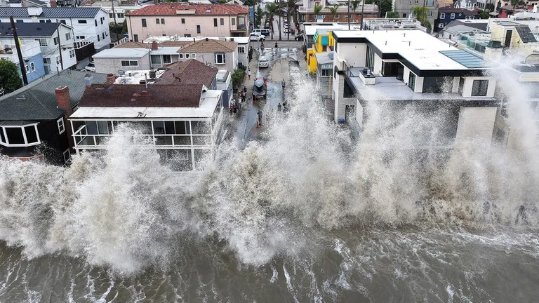
The potential consequences include significant changes in rainfall, with some regions facing an increased risk of drought while others could experience heavier precipitation and flooding. The WMO’s October–December outlook indicates a greater likelihood of above-average temperatures across large parts of the world. Wetter-than-normal conditions are forecast to be more likely in areas including the Greater Horn of Africa, parts of Central Asia and coastal East Asia, while drier conditions are expected in parts of the Indian subcontinent, the western Pacific and sections of Central and South America. These are seasonal probabilities rather than precise predictions for individual communities, meaning national weather services will still need to provide location-specific forecasts. Nevertheless, the outlook highlights the importance of preparing for potentially disruptive weather conditions over the coming months.
The strengthening El Niño could also contribute to higher global temperatures by releasing additional heat from the tropical Pacific into the atmosphere. Climate scientists have warned that this natural warming cycle is occurring against a background of human-driven climate change, which has already increased average global temperatures. The combination could make heat extremes more severe in some regions and place additional pressure on agriculture, water supplies, public health and electricity systems. Researchers are also examining how the event could affect marine ecosystems, fisheries and coral reefs, particularly where warmer ocean temperatures place stress on marine life. However, the precise consequences will vary by region, and scientists caution that El Niño does not produce identical effects every time it occurs.
The WMO expects the current El Niño to intensify towards a likely peak in December and persist into early 2027, although the timing and strength of its eventual decline remain subject to forecast uncertainty. Governments, humanitarian organisations and emergency-management agencies are being encouraged to use seasonal climate information to prepare for heatwaves, water shortages, flooding and possible agricultural losses. Farmers may need to adjust planting decisions, while health authorities can strengthen heat-response plans and communities can improve drainage and water-management systems where risks are elevated. For countries vulnerable to climate extremes, early warnings and practical preparation can help reduce the damage caused by changing weather patterns. The record-breaking Pacific temperatures are a serious warning sign, but they do not mean that every region will experience disaster. Continued monitoring and timely local forecasts will be essential as the event develops.